National Hurricane Center monitoring two weather disturbances
The US National Hurricane Center (NHC) is tracking two areas of interest- one in the Southwestern Atlantic Ocean and the other in the Southwestern Caribbean Sea.
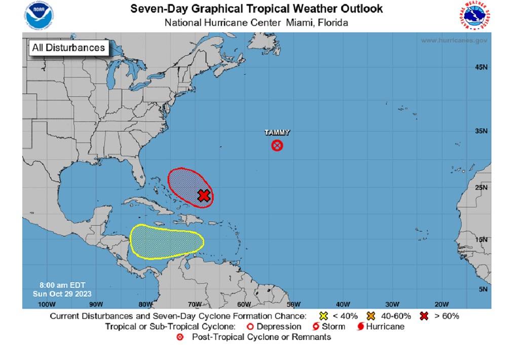
NHC, in its 8 a.m. update, says in the Southwestern Atlantic Ocean, showers and thunderstorms associated with an area of low pressure located a couple of hundred miles east of the southeastern Bahamas continue to show signs of organisation.
A short-lived tropical depression or storm will likely form later today or tonight while the system moves west-northwestward.
By Tuesday, however, strong upper-level winds and dry air should end the chances of further development. An Air Force reconnaissance aircraft is scheduled to investigate the system later today.
The disturbance has a 70 per cent (high) formation chance through 48 hours and a 70 per cent (high) formation chance through 7 days.
Meanwhile, in the Southwestern Caribbean Sea, a broad area of low pressure could form in a few days over the central or southwestern Caribbean Sea. Gradual development after that is possible while the system moves generally westward at 10 to 15 mph. This disturbance has a near 0 per cent (low) formation chance through 48 hours and a 20 per cent (low) formation chance through 7 days.
And Tammy is now a post-tropical cyclone. The NHC says this is its last advisory on Tammy, about 670 miles east of Bermuda.


0 Comment